
{{product.productLabel}} {{product.model}}
{{#if product.featureValues}}{{product.productPrice.formattedPrice}} {{#if product.productPrice.priceType === "PRICE_RANGE" }} - {{product.productPrice.formattedPriceMax}} {{/if}}
{{#each product.specData:i}}
{{name}}: {{value}}
{{#i!=(product.specData.length-1)}}
{{/end}}
{{/each}}
{{{product.idpText}}}

... In a world increasingly driven by digital identity and the demand for mobile identification solutions, both public and private sectors are responding by embracing innovative identification and verification technologies. As a leading global provider ...
Thales - Cybersecurity & Digital Identity

The Thales Document Reader AT10K-m allows users to inspect, authenticate, and capture data from electronic travel and identity documents quickly and with unmatched reliability. Designed for the most demanding environments—whether in border management, ...
Thales - Cybersecurity & Digital Identity

In today’s fast-paced world, ensuring compliance with laws and safeguarding your business against fraud is more critical than ever. One of the paramount steps in this process is the swift and accurate collection of information to determine whether an ...
Thales - Cybersecurity & Digital Identity

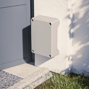
... The RFID Elevator Controller for Visionline systems is designed to fit into elevator panels and can be operated offline or online. It improves the security level of the hotel, as only guests with a valid keycard will have access to the elevators. Vingcard’s ...
Length: 700, 1,000 mm
Width: 1,000 mm - 3,000 mm
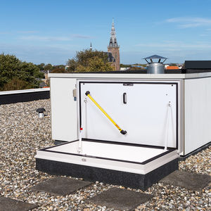
... Gorter roof hatches can be used as escape hatches, but in most situations, they provide practical and safe access to flat roofs for maintenance work or to a roof terrace. Roof hatches can be installed on flat roofs with a maximum slope of 30°. New ...
Gorter
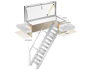
Length: 2,500 mm
Width: 1,000 mm
Thickness: 280 mm
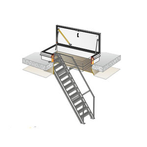
Gorter roof hatches with fixed stairs provide practical and safe access to flat roofs for maintenance work, to a rooftop terrace, roof garden or solar collectors and other facilities on the roof. Roof hatches can be installed on flat roofs with a maximum ...
Gorter
Length: 2,000 mm
Width: 1,000 mm
Thickness: 280 mm
Gorter roof hatches with fixed stairs provide practical and safe access to flat roofs for maintenance work, to a rooftop terrace, roof garden or solar collectors and other facilities on the roof. Roof hatches can be installed on flat roofs with a maximum ...
Gorter

... COMINFO Door SPA terminal complemented with Cominfo EasyScan W reader is a compact and space-saving paid access solution that guarantees a sufficient level of security for premises with a modest number of visitors. An emphasis to offer a product that ...
COMINFO

Door SPA mini payment terminal offers a compact and space-saving solution for paid access, that guarantees a sufficient level of security for the customer‘s premises. The payment terminal directly controls the electromagnetic door lock. It is unlocked ...
COMINFO

... In contemporary buildings, people need to be able to move around quickly and comfortably. On the other hand, several security measures have to be taken that help curbs unauthorized access. Integration of LiftCall mini with an elevator destination ...
COMINFO
Length: 1,000 mm - 1,500 mm
Width: 1,000 mm - 1,500 mm
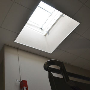
The ECOLUX ACCES TOITURE roof access unit is fitted on waterproofed roofs. It features a flat or angled galvanised steel kerb and a multi-wall polycarbonate cover. This rooflight offers an optimum and free natural daylight contribution, along with easy ...

Length: 1,100, 1,500 mm
Width: 1,100, 1,500 mm
ECOBAC ROOF ACCESS is a roof access unit for installation in dry roofs. This rooflight offers an optimum and free natural daylight contribution, along with easy access to the roof. It is fitted with several components: handrail, opening grill, ladder ...
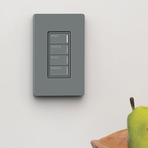
... Customized your way The Sunnata RF keypad’s wireless technology makes it a great fit for both retrofit and new construction projects. The keypad offers 3-button with raise/lower, 2-button and 4-button configurations. With multiple font options and ...
LUTRON ELECTRONICS
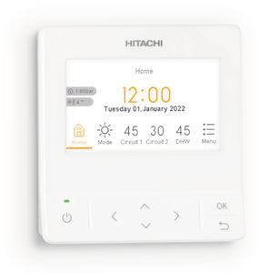
... With a sleek, award-winning design, our new advanced color controller is easy to use and is compatible with the full range of Yutaki air-to-water heat pumps including the latest POWER+ models. Set-up wizard An intuitive 10-question configuration ...
HITACHI
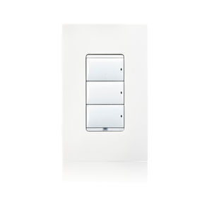
Control4 Keypads provide a stunning interface for your Control4 Smart Home system, combining flexible button configuration with beautiful aesthetics to complement the decor of your home. With the simple press of a button, you can activate a scene, allowing ...
Control4
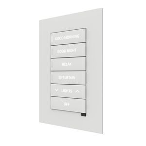
... Overview
The CM2-KPFCN Cameo® 2 flush keypad provides Cresnet® network control of lighting, shading, audio, and other building amenities. ENGRAVED models ship with laser-etched button legends and can be configured with up to 136 button arrangements. ...
SOMFY
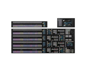
... Assignable modular X-Panel design for XVS Series and MLS-X1 switchers Sony is the pioneer of the modular style of design with the heart of operations for video switchers. Now Sony envolves the new swither control panel as ICP-X7000 Series Control Panel ...
Sony Broadcast & Professional Europe CCTV
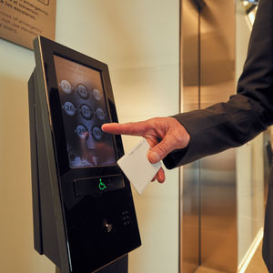
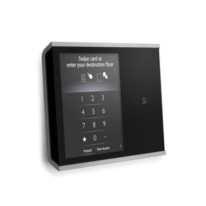
... Schindler PORT Lift is our advanced destination dispatch system that ensures minimal waiting times and optimal passenger comfort. A system this sophisticated needs an exceptional set of fixtures to facilitate the multitude of features that are built ...
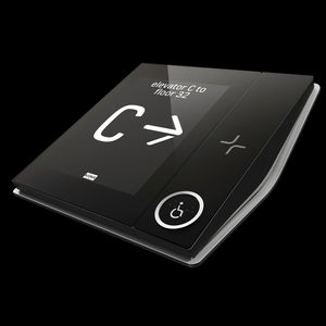
Our Compass® 360 destination management system ensures easy travel for all passengers, with shorter wait times and faster, more efficient journeys. Compass 360 also acts as a virtual concierge to guide passengers to the appropriate elevators and spaces ...
Otis
... Note: This system is applicable to certain elevator models only. For further information, Contact Us or local Mitsubishi sales agent. Comfortable elevator operation and ride under ever-changing usage conditions – that's the concept realized with the ...
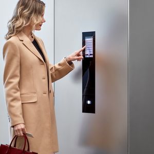
... KONE Access is a scalable and flexible access control system that is seamlessly integrated with your lift system and building doors. The solution combines user interface devices, system hardware and access control management software. In addition to ...
KONE
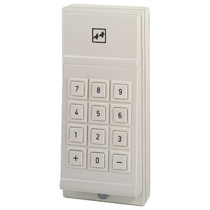
This effective door code device is installed alongside the door. A compatible electric door strike is fitted into the door frame as the counterpart to the door lock. Keypad and control electronics are housed in a single casing. You can programme the access ...
Eff Eff
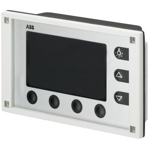
For indication of switching status, fault reports and measurement values. Using the robust push buttons, electrical consumers can be manually switched, values can be set in addition to timer programs and light scenes. The alarms can also issue an acoustic ...
ABB Home and Building Automation
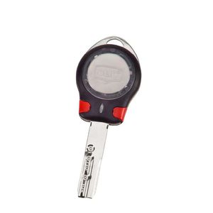
... Function The CLIQ® Control Key (C-Key) manages the electronic communication provided by the CLIQ® system. It provides users secure access to the system software and the ability to transfer information between the software and cylinders. Applications Each ...
Mul-T-Lock®

... Our PasSec speed gate provides robust security at airport arrivals by preventing passengers from returning into secure or sensitive areas once cleared. As passengers arrive at their destination airport, PasSec gates enable fast flow of high passenger ...
GUNNEBO ENTRANCE CONTROL
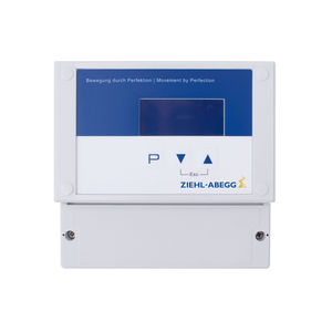
Display and operating terminals for frequency inverters and EC motors – available in a range of versions – make it easier to operate your ventilation system: The AXG-1A display and operating terminal can be flexibly mounted on the ventilation system in ...
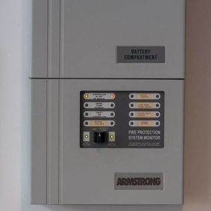
... An essential component of any fire alarm system, the control panel is the centre of the operation. It is from here that all detection devices, sounders and signalling elements of the fire alarm system are monitored and controlled. The control panel also ...
Chubb
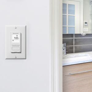
Replace your normal bathroom switch with the Digital Bath Fan Control. The control comes with a programmable fan timer so your bathroom vent will turn off automatically, helping you save energy. The smart bathroom fan switch also conveniently displays ...
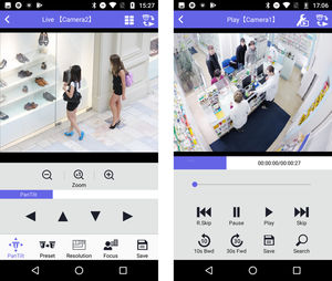
i-PRO Mobile APP is an application that can view the images from i-PRO Smart HD Series / i-PRO EXTREME Network Cameras, i-PRO Network Disk Recorder or Digital Video Recorder (WJ-HD616/WJ-HD716). By connecting a terminal to a 3G/4G or wireless LAN (Wi-Fi), ...
i-pro

Prevent the entry of unauthorized persons to your building with the 2N IP Access Control system. The nerve centre of the whole system is 2N® Access Commander with its simple and intuitive user interface. Use it not only for managing access to the building, ...

... These are lifestyle cylinder locks with both visual and acoustic access signals. They are compact, energy efficient and extremely easy to install. The many different versions offer a solution for every door. • EN 1634-1 or BS 476: Part 22:1987 • BS ...
dormakaba