- Building & Construction
- Construction site equipment
- Laser scanner
- LEICA PRECISION TOOLS BY LEICA GEOSYSTEMS
- Products
- Catalogs
- News & Trends
- Exhibitions
Laser scanner BLK360 3Dself-leveling


Add to favorites
Compare this product
Characteristics
- Technology
- laser
- Number of axes
- 3D
- Options
- self-leveling
Description
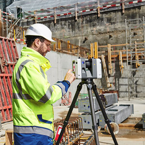
The Leica BLK360 captures the world around you with full-colour panoramic images overlaid on a high-accuracy point cloud. Simple to use with just the single push of one button, the BLK360 is the smallest and lightest of its kind. Anyone who can operate an iPad can now capture the world around them with high resolution 3D panoramic images.
Using the ReCap Pro mobile app, the BLK360 streams image and point cloud data to iPad. The app filters and registers scan data in real time. After capture, ReCap Pro enables point cloud data transfer to a number of CAD, BIM, VR and AR applications. The integration of BLK360 and Autodesk software dramatically streamlines the reality capture process thereby opening this technology to non-surveying individuals.
BLK360 Imaging Laser Scanner
Allows you to scan in high, standard and fast resolutions
Weighs 1kg / Size 165 mm tall x 100 mm diameter
Less than 3 minutes for full-dome scan (in standard resolution) and 150 MP spherical image generation
360,000 laser scan pts/se
HDR and thermal imaging
Catalogs
No catalogs are available for this product.
See all of LEICA PRECISION TOOLS BY LEICA GEOSYSTEMS ‘s catalogsExhibitions
Meet this supplier at the following exhibition(s):


Other LEICA PRECISION TOOLS BY LEICA GEOSYSTEMS products
Laser Scanners
Related Searches
- Level
- Laser level
- Receiver
- Horizontal level
- Vertical level
- Automatic level
- Construction site receiver
- Scanner
- Laser scanner
- Total station
- Rotary level
- RTK receiver
- GNSS receiver
- Precision level
- Reflectorless total station
- Wireless receiver
- Bluetooth total station
- Radio data transmission receiver
- Total station with prism
- Optical level
*Prices are pre-tax. They exclude delivery charges and customs duties and do not include additional charges for installation or activation options. Prices are indicative only and may vary by country, with changes to the cost of raw materials and exchange rates.


