
{{product.productLabel}} {{product.model}}
{{#if product.featureValues}}{{product.productPrice.formattedPrice}} {{#if product.productPrice.priceType === "PRICE_RANGE" }} - {{product.productPrice.formattedPriceMax}} {{/if}}
{{#each product.specData:i}}
{{name}}: {{value}}
{{#i!=(product.specData.length-1)}}
{{/end}}
{{/each}}
{{{product.idpText}}}
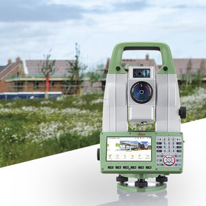
... self-learning total station. Automatically adjusting to any environmental conditions, the Leica Viva TS16 locks onto your, and only your, target. Regardless of how challenging the task or the amount of distractions in ...
LEICA PRECISION TOOLS BY LEICA GEOSYSTEMS

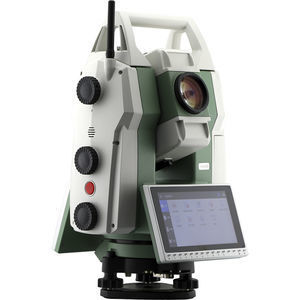
... The Zoom95 is the true flagship of the GeoMax TPS portfolio. Featuring advanced STReAM360 technology, this one-person total station substantially minimises the time of any survey task and maximises your performance and ...
GEOMAX
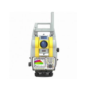
... high-precision robotic total station launched by FOIF. It adopts high-speed direct drive motor technology, which rotates faster and has more accurate positioning. It integrates high-speed automatic aiming, ...
... MOTORIZED TOTAL STATION FOR CONSTRUCTION, SURVEYING AND MORE The GeoMax Zoom90 is a professional, motorized total station with automatic 360° prism search, continuous ...
... classic functions of the program, as well as the integration of jobs done with GNSS and surveys done with the total station. This allows operators to achieve complex and professional work in a short time ...
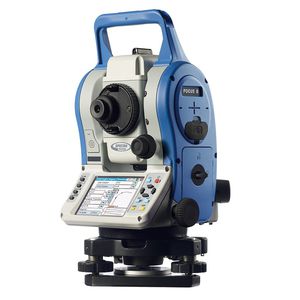
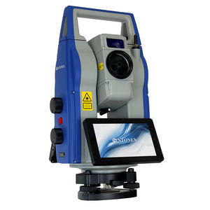
... The Spectra Precision® FOCUS® 8 Total Station offers the power of a Windows CE operating system and world class Spectra Precision Survey Pro field software combined with clear-to-view quality optics, smart design, and ...
the best suppliers