- Building & Construction
- Construction site equipment
- Optical level
- LEICA PRECISION TOOLS BY LEICA GEOSYSTEMS
- Products
- Catalogs
- News & Trends
- Exhibitions
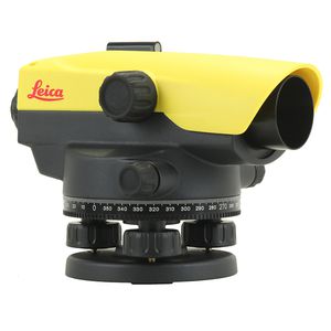
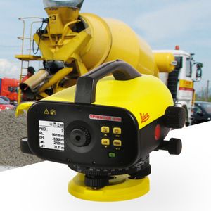
Optical level LS15 & LS10precisiondigital


Add to favorites
Compare this product
Characteristics
- Type
- optical
- Other characteristics
- precision, digital
Description
For trusted surveyors and measuring professionals, getting a full day’s worth of highly precise levelling measurements is not only stressful but an unusually complex and redundant job.
Leica LS15 and LS10 digital levels give a welcome chance to alleviate demanding levelling tasks. Automated functions and industry-leading 0.2mm accuracy allow users to easily demonstrate their measuring skills while effectively completing any project.
From autofocus to touchscreen displays with clean layouts, the entire measurement process is made more efficient with LS15 and LS10 digital levels. Common levelling errors, like misreading the staff or transcription mistakes, are worries of the past. Providing the most reliable results from immediately understandable line flows with image-supported colour visuals, these levelling solutions make the professional’s daily tasks a more enjoyable experience.
Users profit from Leica Geosystems’ experience as inventors and industry leaders of digital levels. Honing the digital level into an art form, these solutions collect results faster with the highest accuracy available.
VIDEO
Catalogs
No catalogs are available for this product.
See all of LEICA PRECISION TOOLS BY LEICA GEOSYSTEMS ‘s catalogsExhibitions
Meet this supplier at the following exhibition(s):


Other LEICA PRECISION TOOLS BY LEICA GEOSYSTEMS products
Levels
Related Searches
- Level
- Laser level
- Receiver
- Horizontal level
- Vertical level
- Automatic level
- Construction site receiver
- Scanner
- Laser scanner
- Total station
- Rotary level
- RTK receiver
- GNSS receiver
- Precision level
- Reflectorless total station
- Wireless receiver
- Bluetooth total station
- Radio data transmission receiver
- Total station with prism
- Optical level
*Prices are pre-tax. They exclude delivery charges and customs duties and do not include additional charges for installation or activation options. Prices are indicative only and may vary by country, with changes to the cost of raw materials and exchange rates.


